
Garmin eTrex 10
4.3Editor score
Compact and lightweight design
Preloaded worldwide basemap
Up to 20 hours battery
Finding the right handheld GPS for geocaching is essential for navigating trails and locating hidden treasures efficiently. A reliable device ensures you stay on track even in remote areas without cellular coverage. Modern units offer detailed maps, long battery life, and rugged designs to withstand outdoor conditions.
We evaluated ten leading handheld GPS devices based on display quality, satellite support, battery performance, and geocaching-specific features. Our analysis focuses on durability, ease of use, and mapping capabilities to provide a comprehensive overview. Each product was assessed for its ability to handle various terrains and weather scenarios effectively.
Each review highlights key strengths, potential trade-offs, and ideal user scenarios for every device on this list. We aim to guide you toward a choice that matches your specific geocaching adventures and budget. Please note that availability and pricing may change over time, so check current listings before purchasing.
4.3Editor score

4.3Editor score

4.0Editor score
As an Amazon Associate we earn from qualifying purchases.
This side-by-side comparison highlights the key specifications and capabilities of each handheld GPS device. We focus on display size, battery endurance, satellite support, and unique features to help you differentiate between models quickly.



The Garmin eTrex 22x stands out as a reliable handheld GPS for geocaching with a bright color display and robust navigation features. Its 4.3 rating reflects consistent performance in tracking locations accurately even in dense forests or deep canyons. Users appreciate the balance between affordability and advanced mapping capabilities provided by this unit.
We may earn a commission when you buy through this link, at no additional cost to you.
This device includes preloaded Topo Active maps that offer routable roads and trails ideal for hiking to cache locations. The 2.2 inch screen provides excellent visibility under direct sunlight, ensuring you can read coordinates without straining your eyes. Support for both GPS and GLONASS satellite systems enhances signal reliability in challenging environments where GPS alone might struggle.
While the unit lacks wireless connectivity and a touchscreen, its physical button design ensures usability with gloves or in wet conditions. Battery life extends up to 25 hours on two AA batteries, which is sufficient for multi-day trips without frequent replacements. Internal memory allows map downloads but adding a micro SD card expands storage significantly for extensive regional maps.
It is best suited for outdoor enthusiasts who prioritize durability and battery life over smart features. If you want a straightforward device for finding geocaches efficiently without relying on smartphone pairing, this model delivers value. The rugged build and intuitive interface make it a top recommendation for serious geocachers seeking reliability.
Support for GPS and GLONASS ensures you maintain a strong signal in dense tree cover or urban canyons.
Using standard AA batteries allows you to carry spares easily for long expeditions without needing chargers.
We may earn a commission when you buy through this link, at no additional cost to you.
The Garmin eTrex 10 offers an accessible entry point into handheld GPS for geocaching with essential navigation tools at a lower cost. Its 4.3 rating indicates solid performance for basic tracking and waypoint management without unnecessary complexity. This model is ideal for beginners or casual users who need dependable direction finding in remote areas.
We may earn a commission when you buy through this link, at no additional cost to you.
It comes with a preloaded worldwide basemap that helps you orient yourself anywhere on the globe immediately out of the box. The device is waterproof to IPX7 standards, protecting it from rain or accidental splashes during outdoor adventures. Physical buttons allow easy operation even with gloves, ensuring control in cold or wet weather conditions.
The monochrome display limits visual appeal compared to color screens but remains readable in bright sunlight. Battery life reaches up to 20 hours on two AA batteries which covers most day trips comfortably. While it lacks GLONASS support, the WAAS enabled GPS receiver provides accurate positioning for typical geocaching needs.
Choose this device if you want a no fuss tool focused on core functionality rather than advanced features. It is perfect for short hikes where weight and cost are primary concerns. The simplicity ensures you spend more time searching for caches and less time troubleshooting technology.
Navigate anywhere in the world with a preloaded basemap that requires no initial setup or downloads.
IPX7 waterproof rating ensures the device survives rain storms or brief immersion in shallow water.
We may earn a commission when you buy through this link, at no additional cost to you.
The Garmin GPSMAP 66s delivers a premium experience for geocaching with a large color screen and advanced sensors for precise tracking. Its renewed status offers a cost-effective way to access high-end features while maintaining reliable performance. Users value the ability to receive up-to-date weather forecasts directly on the device while exploring.
We may earn a commission when you buy through this link, at no additional cost to you.
This model supports multiple global navigation satellite systems including GPS GLONASS and Galileo for superior signal acquisition in difficult terrain. The built-in barometric altimeter helps you monitor elevation changes which is useful for identifying caches in mountainous regions. Wireless connectivity allows seamless syncing with smartphones for faster updates and trip planning.
BirdsEye Satellite Imagery provides high resolution aerial views that enhance map detail without needing additional subscriptions. The 3 inch display offers ample space to view maps and coordinates clearly even in bright sunlight. While renewed units may show minor wear, they undergo testing to ensure functional integrity.
Ideal for serious adventurers who need comprehensive data and connectivity without relying solely on a phone. The combination of sensors and display quality makes it a top choice for extended trips. Consider this if you prioritize detailed navigation features and are willing to invest in a higher-end tool.
Access multiple global satellite networks to ensure continuous tracking even in dense forests or deep valleys.
Receive active weather forecasts and radar animations directly on your device to plan routes safely.
We may earn a commission when you buy through this link, at no additional cost to you.
The Garmin eTrex SE is designed for endurance, offering up to 168 hours of battery life in standard mode for extended expeditions. Its 4.2 rating reflects consistent performance in navigation and ease of use for geocaching tasks. This device is particularly useful for long weekend trips where recharging options are unavailable.
We may earn a commission when you buy through this link, at no additional cost to you.
It supports automatic cache updates from Geocaching Live when paired with the Garmin Explore app on a smartphone. This connectivity ensures you have the latest descriptions hints and logs without manual downloads each time. Multi-GNSS support allows tracking in more challenging environments by accessing GPS GLONASS Galileo and other satellite systems.
The digital compass provides accurate heading even when stationary which helps when locating caches in tight spaces. Water-resistant design rated to IPX7 protects against rain and splashes ensuring durability in wet conditions. While internal storage is limited, it focuses on functionality and battery efficiency over media storage.
Choose this model if you plan long hikes where battery reliability is critical. The ability to sync cache data automatically simplifies preparation before heading into the field. It balances modern connectivity with traditional rugged GPS utility effectively.
Up to 168 hours in standard mode ensures you never run out of power during multi-day adventures.
Pair with your smartphone to download cache updates and receive weather alerts wirelessly.
We may earn a commission when you buy through this link, at no additional cost to you.
This handheld GPS for hiking offers a large 3.2 inch screen and generous storage at an affordable price point. Its 3.9 rating suggests it meets expectations for basic geocaching but may lack the refined durability of top brands. The device provides essential navigation tools including Multi-GNSS support for better positioning accuracy.
We may earn a commission when you buy through this link, at no additional cost to you.
With 32 GB of internal memory you can store extensive maps without needing additional cards. The rechargeable battery provides up to 36 hours of life on a full charge which is convenient for long trips. Physical buttons ensure control even in wet conditions where touchscreens might fail to register input.
Multi-GNSS support includes GPS Galileo BeiDou and QZSS to improve location precision within six feet. The water-resistant design rated to IP66 protects against rain and dust exposure during outdoor activities. Preloaded USA Topo maps facilitate easy navigation in familiar regions without extra setup.
It serves as a budget-friendly alternative for users who want a large screen and storage without high costs. Consider this if you prioritize screen real estate and battery capacity over brand reputation. Testing may be recommended for critical missions given the varied user feedback.
A 3.2 inch screen provides clearer map details making it easier to read coordinates in bright sunlight.
32 GB internal memory allows storage of detailed maps for entire states or regions.
We may earn a commission when you buy through this link, at no additional cost to you.
The Garmin eTrex 32x improves on previous models with a barometric altimeter and high resolution color display for precise navigation. Its 4.2 rating highlights user satisfaction with its tracking accuracy and robust construction. This unit is well-suited for hikers who need elevation data while searching for geocaches.
We may earn a commission when you buy through this link, at no additional cost to you.
The 2.2 inch screen displays maps with improved clarity to help identify trails and terrain features quickly. Support for GPS and GLONASS ensures consistent signal strength in areas with obstructed views. A micro SD card slot allows you to expand storage beyond the internal 8 GB limit.
Battery life reaches up to 25 hours on two AA batteries which is reliable for full day excursions. The device is built to withstand harsh outdoor conditions making it a dependable companion in varied weather. Physical buttons provide tactile feedback that simplifies menu navigation without looking at the screen.
Choose this model if you want altitude tracking and better screen quality within the eTrex line. It bridges the gap between budget devices and premium models with essential sensors. Ideal for those who value physical controls and proven durability in a GPS unit.
Track elevation changes accurately to assist in locating caches in mountainous or hilly terrain.
Add a micro SD card to store additional maps without sacrificing internal memory for navigation.
We may earn a commission when you buy through this link, at no additional cost to you.
The Garmin Oregon 550T combines navigation with a built-in digital camera allowing you to capture images of geocaches directly. Its 4.3 rating reflects strong performance in usability and ruggedness for outdoor adventures. The device is waterproof and includes a barometric altimeter for precise elevation monitoring.
We may earn a commission when you buy through this link, at no additional cost to you.
A 3 inch color touchscreen provides an intuitive interface for accessing maps and managing waypoints easily. The 3.2 megapixel autofocus camera takes photos that can be tagged with coordinates for documentation. This feature is unique to this model and appeals to those who want visual records of their finds.
Waterproof design ensures protection against rain or immersion which is essential for unpredictable weather. However battery life is shorter than newer models requiring more frequent changes during long trips. The older technology may lack modern connectivity features like wireless updates found in recent releases.
Select this if camera integration is a priority for your geocaching documentation needs. The rugged build and touchscreen interface make it user-friendly for various skill levels. Consider it as a specialized tool for visual logging alongside standard navigation functions.
Capture high-quality photos of caches directly on the device with automatic geotagging.
Use your finger to navigate menus and maps instead of relying solely on physical buttons.
We may earn a commission when you buy through this link, at no additional cost to you.
The Garmin Montana 680 features a large 5 inch touchscreen that displays maps and coordinates with exceptional clarity. Its 4.1 rating indicates solid performance for users needing detailed views during navigation. With 250,000 preloaded worldwide geocaches this device is ready for extensive exploration out of the box.
We may earn a commission when you buy through this link, at no additional cost to you.
An 8 megapixel digital camera captures high resolution images which geotag with coordinates automatically for your records. This capability supports documentation needs without requiring a separate camera during hikes. The interface is designed for intuitive use making it accessible even for those new to handheld GPS units.
The larger screen requires more power so battery life may be shorter compared to smaller units like eTrex. Weight is also higher which might be a factor for long hikes where minimizing load is crucial. BirdsEye imagery subscription provides high resolution satellite views to enhance map detail.
Choose this for its screen size and cache database if you prefer detailed map views over portability. It is ideal for users who value visual documentation and ease of use. Consider the trade-offs in weight and battery when planning long distance trips.
Access 250,000 preloaded worldwide geocaches without needing to download individual files.
Enjoy a 5 inch screen for easier navigation and better visibility of complex maps.
We may earn a commission when you buy through this link, at no additional cost to you.
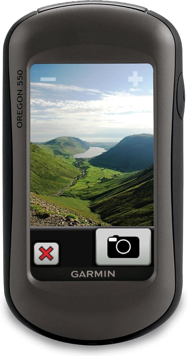
The Garmin Oregon 550 combines a durable waterproof build with essential sensors for reliable geocaching navigation. Its 4.0 rating suggests it meets standard expectations for a rugged handheld GPS with camera capabilities. The tilt-compensated compass provides accurate heading even when you are moving or holding the device at an angle.
We may earn a commission when you buy through this link, at no additional cost to you.
A 3 inch color touchscreen offers easy navigation through maps and menus with clear visuals. The 3.2 megapixel autofocus camera helps document your journey and find coordinates for later reference. Preloaded worldwide basemaps with shaded relief improve terrain visualization without additional downloads.
Barometric altimeter tracks pressure changes to pinpoint altitude which is valuable for elevation-based caches. While the device is feature-rich it may feel slower compared to newer models with advanced processors. Battery life is moderate requiring planning for long excursions without recharging options.
It is a solid choice for users who want a balanced mix of sensors and durability. The waterproof design ensures reliability in wet conditions during outdoor adventures. Consider it if you prioritize camera integration and compass accuracy over processing speed.
Get accurate heading readings without holding the device perfectly level at all times.
View terrain features clearly with shaded relief maps that highlight elevation changes visually.
We may earn a commission when you buy through this link, at no additional cost to you.
The Garmin Oregon 200 is a compact handheld GPS suitable for basic navigation and geocaching tasks. Its 3.2 rating indicates it serves well for casual use but may lack advanced mapping precision compared to newer units. The device features a high sensitivity GPS receiver that ensures quick signal acquisition in open areas.
We may earn a commission when you buy through this link, at no additional cost to you.
A 2.6 inch color TFT display provides clear visibility of maps and coordinates during travel. Rugged touch-screen technology allows easy interaction with the interface while maintaining durability in outdoor settings. Built-in worldwide basemap supports general orientation without requiring immediate downloads.
It includes five user profiles for automotive marine recreation fitness or geocache to tailor settings to activity. The lightweight design makes it comfortable to carry on short hikes or city walks. However processing speed and feature set are limited which may frustrate power users seeking detailed map data.
Choose this for straightforward navigation needs where simplicity and portability are paramount. It is ideal for beginners who want an affordable entry into handheld GPS technology. Keep expectations in mind regarding accuracy and advanced functionality when selecting this model.
Switch between five activity profiles to optimize settings for different outdoor or indoor activities.
Interact with the device using touch controls designed to work with gloves or in wet conditions.
We may earn a commission when you buy through this link, at no additional cost to you.
Selecting the right handheld GPS for geocaching depends on understanding key features that impact navigation accuracy and durability. We break down the factors you should consider to find a device that fits your outdoor style.
A clear sunlight-readable display is essential for viewing maps and coordinates during the day. Color screens offer better contrast and detail compared to monochrome options making them easier to interpret quickly.
Look for screens with at least 2.2 inches and high pixel counts to ensure readability in bright conditions.
Battery endurance determines how long you can rely on the device without carrying spares or chargers. Models using AA batteries allow quick replacements whereas rechargeable units need charging stations.
Choose a unit with at least 20 hours of life for full day excursions to avoid power interruptions.
Multi-GNSS support like GPS GLONASS and Galileo ensures you maintain a signal in dense forests or canyons. This feature improves positioning accuracy significantly in challenging environments.
Verify that the device supports at least two satellite systems for reliable tracking outdoors.
Geocaching often involves hiking in wet conditions where rain or streams may splash the device. An IPX7 or higher rating ensures the unit survives temporary immersion or heavy rain.
Prioritize waterproof models to protect your investment from weather-related damage.
Internal memory allows storage of detailed maps and waypoints for future use. Expandable slots like micro SD offer flexibility for large map files.
Check if preloaded maps cover your target regions to avoid needing additional purchases.
Wireless connectivity enables syncing cache data and updates from smartphones quickly. This feature reduces manual download steps and keeps information current.
Consider models with Bluetooth or Wi-Fi if you plan to use geocaching apps regularly.
Physical buttons provide better usability than touchscreens when wearing gloves or in wet weather. Tactile feedback ensures you can navigate menus without looking at the screen.
Choose a device with a mix of buttons and touch for balanced control options.
A rugged design resists shocks and drops common in outdoor environments. Look for reinforced casing and reliable seals to ensure long-term use.
Durability features extend the lifespan of your GPS especially during rough terrain hikes.
To start using your GPS device charge the batteries or insert fresh AA cells before heading out. Power on the unit and allow it to acquire a signal by waiting in an open area until the satellite icon is stable.
Download your geocaching waypoints or cache coordinates before leaving home if you rely on offline maps. Use the trackback feature to record your path so you can return to your starting point easily.
Keep your device dry and clean after use by wiping it with a soft cloth and removing dirt. Store it in a cool dry place and check battery terminals regularly to prevent corrosion.
Yes handheld GPS devices use satellite signals to determine your location so they do not rely on cellular networks. This makes them ideal for geocaching in remote areas where phone coverage is unavailable.
Battery life varies by model but many devices offer 20 to 100 hours on AA batteries. Rechargeable units may provide 10 to 30 hours per charge depending on usage settings.
Most modern handheld GPS units support paperless geocaching by allowing waypoints for cache locations. Some models like the eTrex 10 and 22x explicitly support this feature for easy loading.
Yes most Garmin devices allow custom map files via microSD cards or direct transfers. This lets you load regional topo maps beyond the preloaded base maps.
Touchscreens offer intuitive navigation but buttons work better with gloves or in wet conditions. Many users prefer a combination for reliability during varied outdoor scenarios.
Preloaded maps are included on most devices without a subscription. Optional satellite imagery or live weather may require a paid service but basic navigation works offline.
The top picks like the eTrex 22x and GPSMAP 66s offer robust features for both beginners and pros. Each device balances durability and performance to suit different outdoor needs.
Prioritize battery life and satellite support to ensure you never get lost while hunting for caches. Choose waterproof and rugged models to protect your device from environmental hazards.
Always check current listings and prices before purchasing as availability and deals change frequently. Select the unit that best matches your adventure style and technical requirements.